India No-Fly Zone Checker
Enter your location coordinates or address below to check if it falls within any restricted airspace in India according to DGCA regulations and DJI geofencing systems.
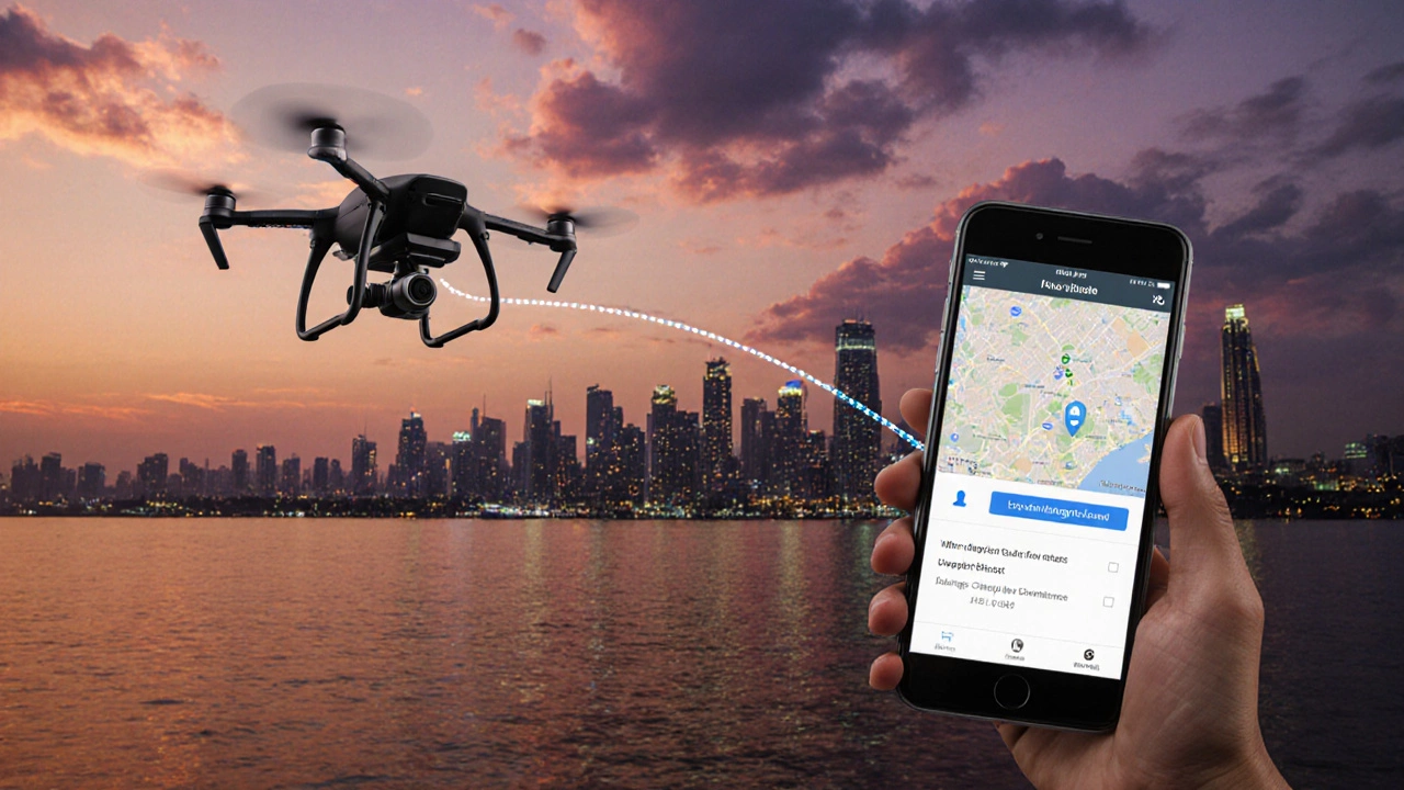
When you launch a DJI drone in India, you’ll quickly wonder: does DJI have no‑fly zones? The short answer is yes-DJI embeds a geofencing system that blocks flights over restricted airspace. But the Indian regulatory landscape adds its own layers, and knowing where you can and cannot fly makes the difference between a stunning shot and a costly fine.
Quick Takeaways
- DJI’s Geofence automatically blocks flights over government‑designated no‑fly zones.
- The Directorate General of Civil Aviation (DGCA) defines restricted, prohibited and controlled zones across India.
- You can check real‑time airspace info in the DJI Fly App or through official DGCA maps.
- If a DJI alert stops you, you can request a temporary unlock via the app - but paperwork is required.
- Always log the exact coordinates before you take off; many incidents happen because pilots assume a zone is open.
What Exactly Is a No‑Fly Zone?
A no‑fly zone is any piece of airspace where unmanned aircraft are prohibited or heavily restricted.
In India the DGCA classifies airspace into three main types:
- Prohibited: No aircraft at all - usually around military bases, nuclear plants, and certain government facilities.
- Restricted: Flights allowed only with prior permission - typical around airports, helipads, and large public events.
- Controlled: Air traffic must be coordinated with ATC - common in busy metro corridors.
Each type has defined coordinates and altitude limits. Crossing them without clearance can lead to fines, seizure of the drone, or even criminal charges.
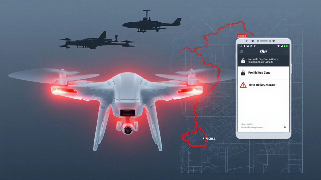
How DJI Handles Geofencing
DJI’s Geofence system is a built‑in database of global no‑fly zones. When you power up the remote, the drone downloads the latest map and cross‑checks your GPS position. If you approach a restricted area, the following happens:
- The drone flashes a red LED and emits an audible warning.
- The DJI Fly App shows a pop‑up with the zone name and reason.
- If the zone is marked “locked,” the drone will refuse to take off or will auto‑return before crossing the boundary.
DJI updates the geofence every 24‑48 hours, but you can force a manual refresh in the app’s settings.
Indian Regulations You Must Follow
The DGCA released the Drone Regulations 2021, which mandate:
- All drones above 250 g must be registered and display a Unique Identification Number (UIN).
- Flying within 5 km of an airport requires a Permission‑for‑Unmanned‑Aerial‑Vehicle (PUAV) clearance.
- Operating over densely populated areas like Mumbai, Delhi, or Bengaluru is only allowed in Controlled airspace with ATC coordination.
- Night‑time flights are prohibited unless you have a special waiver.
Failure to comply can result in penalties up to ₹50,000 per incident, plus possible confiscation of the drone.
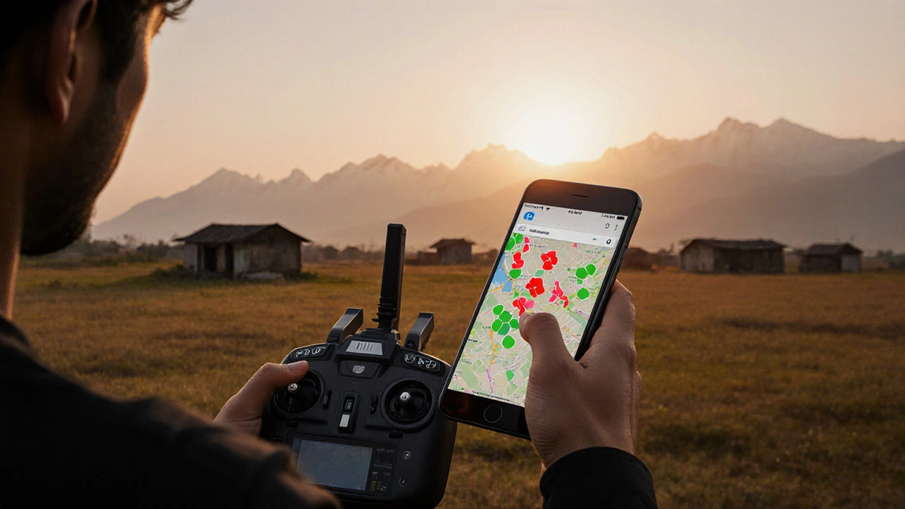
Checking No‑Fly Zones Before You Fly
Here’s a step‑by‑step routine that keeps you on the safe side:
- Open the DJI Fly App and enable the “Live Map” feature.
- Enter your exact take‑off coordinates or let GPS auto‑detect.
- Zoom into the map and look for red‑shaded polygons - those are DJI‑locked zones.
- Cross‑reference the highlighted areas with the DGCA’s official online airspace map. The two should match; any discrepancy means a recent update.
- If you see a locked zone you need to cross, tap “Request Unlock” in the app. You’ll be prompted to upload a copy of your PUAV clearance or other supporting documents.
- Wait for confirmation (usually 24 hours) before attempting the flight.
Doing this checklist once per flight habitually saves you from surprise lock‑outs mid‑mission.
Workarounds and Appeal Process
Sometimes a DJI lock‑out feels unnecessary-perhaps you’re filming a wedding over a park that happens to sit inside a larger prohibited zone. In those cases you have two options:
- Temporary Unlock: Submit a formal request through the app with proof of event permits, location plans, and insurance. The DGCA reviews it and may grant a 2‑hour window.
- Manual Override (Risky): Some older DJI models allow you to disable the geofence via firmware hacks. This is illegal in India and will void your warranty, so we strongly advise against it.
Remember, the safest route is always to work within the official framework.
Common Pitfalls Indian Pilots Face
- Assuming “Open Space” Means No Restrictions: Even rural fields can lie under a restricted military corridor.
- Relying Solely on the Drone’s LED Alerts: The red flash only appears when you get within 30 m of the boundary; you might already be too close for a safe correction.
- Forgetting to Refresh the Geofence: If you haven’t powered on the app for a week, you could be using an outdated map.
- Ignoring Altitude Limits: Some zones allow low‑altitude flights (< 120 ft) but still block higher ascents.
Keeping these in mind makes your shooting sessions smoother and keeps the DGCA happy.
Mini‑FAQ
Does DJI automatically block all no‑fly zones worldwide?
DJI’s geofence covers most major prohibited areas, but it relies on regular map updates. In countries with rapidly changing airspace rules, you should still verify with local aviation authorities.
Can I fly a DJI drone over a stadium during a public event?
Stadiums are typically classified as restricted zones during events. You’ll need a PUAV clearance from the DGCA and a special permit from the event organizer. DJI will lock the flight until the clearance is uploaded.
What should I do if my DJI drone suddenly lands in a no‑fly zone?
The drone will execute an automatic return‑to‑home (RTH) if the geofence is triggered. After landing, inspect the aircraft, note the coordinates, and report the incident to the DGCA if required. Avoid flying again until you’ve cleared the zone.
Is there a difference between DJI’s “Unlock” and the DGCA’s “PUAV” permission?
Yes. DJI’s unlock is a software request that tells the drone it may cross a specific geofence after you upload the DGCA’s PUAV clearance. Without a valid PUAV, the unlock will be denied.
Do older DJI models have the same geofencing capability?
Most models released after 2018 include the geofence feature. Earlier units like the Phantom 2 lack it, meaning pilots must manually check airspace maps.
Comparison Table: DJI Geofencing vs. Competing Brands
| Brand | Database Coverage | Auto‑Return on Violation | Unlock Process |
|---|---|---|---|
| DJI | Global (incl. India’s DGCA zones) | Yes - immediate RTH | App‑based request + PUAV upload |
| Autel Robotics | Partial - focuses on airports | Yes - limited to altitude breach | Email to support, slower |
| Parrot | Minimal - user‑defined only | No automatic RTH | Manual GPS waypoint editing |
For Indian operators, DJI’s comprehensive map and seamless app integration make it the safest choice, especially when you’re juggling permits for city shoots.
Next Steps for Every Drone Enthusiast
- Register your drone on the DGCA portal and get a UIN.
- Download the latest DJI Fly App and enable automatic map updates.
- Run the pre‑flight checklist above before each session.
- If you’re planning a commercial shoot near an airport, apply for PUAV clearance at least 5 days in advance.
- Keep a digital copy of all approvals on your phone; the app will pull them automatically.
Following these steps means you’ll spend more time framing the perfect shot and less time worrying about legal trouble.
Final Thoughts
Yes, DJI does have no‑fly zones, and they’re tightly woven into India’s airspace rules. The system is designed to protect both people and your expensive equipment. By treating the geofence as a partner rather than a nuisance, you’ll fly smarter, stay compliant, and capture the kind of footage that makes clients say, “Wow, that’s amazing.”